
Newsletter Subscribe
Enter your email address below and subscribe to our newsletter
Enter your email address below and subscribe to our newsletter

Watch CBS News
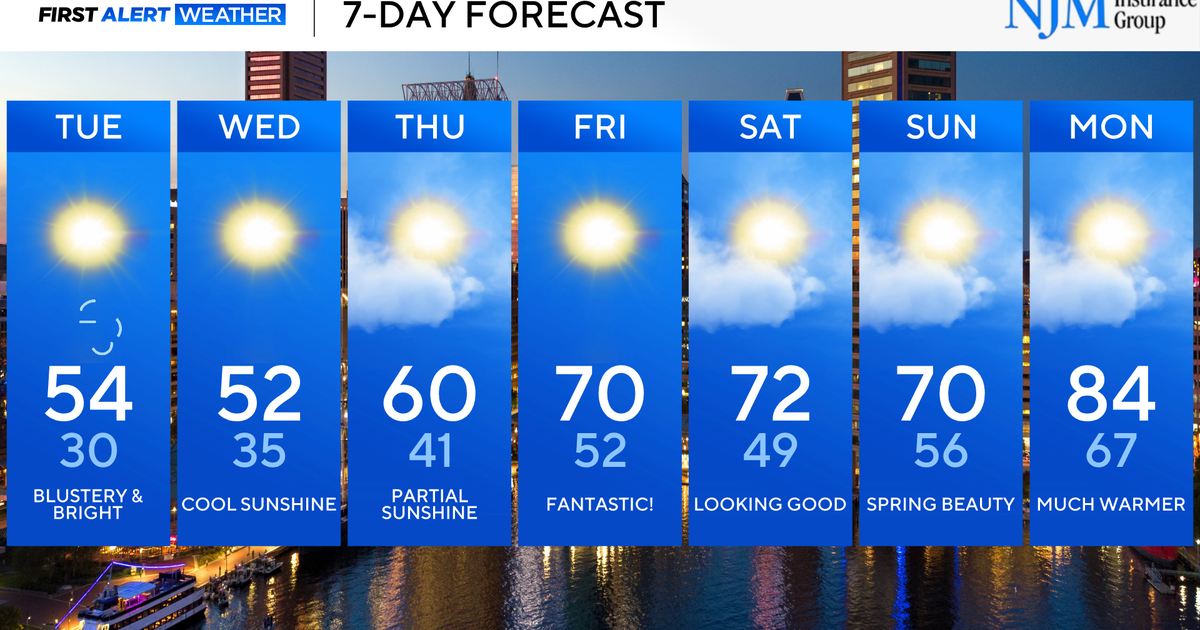
Cooler weather has blown back into Maryland, behind Easter Sunday rain. Another push of cold air arrives tonight, into Tuesday. Mid-week marks the chilliest point of the forecast, followed by a warming trend.
A Freeze Watch is in effect for Tuesday night and Wednesday morning. Gardeners, sensitive plants will need to be covered or moved indoors.
A reinforcing shot of colder air will arrive with a chance of sprinkles and spotty rain showers this evening. Temperatures drop back into the low to mid-40s in many neighborhoods by sunrise on Tuesday morning.
Tuesday will feature plenty of sunshine. But, it will be chillier. Temperatures only peak in the low to mid-50s on Tuesday afternoon. Breezy winds will make it feel even chillier. It’ll trend even colder on Tuesday night. A widespread freeze is likely by Wednesday morning across most of Maryland. Temperatures plunge into the mid and upper 20s outside of the Baltimore Beltway and closer to 30° in the city.
Cool sunshine continues through Thursday, ahead of warmer weather.
The second weekend of April looks to be another winner! There is a chance of brief light rain on Saturday. Aside from that, the forecast looks great for plans. Temperatures peak in the mid-70s on Saturday and closer to 70° on Sunday.
Much warmer weather moves into Maryland next workweek.