
Newsletter Subscribe
Enter your email address below and subscribe to our newsletter
Enter your email address below and subscribe to our newsletter


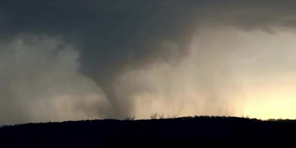
Dangerous severe weather is expected to develop across the Central U.S. early Friday afternoon. Supercell thunderstorms capable of producing strong (EF-3) tornadoes could form across parts of Wisconsin, Minnesota, and northeast Iowa. Supercells are also possible from Kansas City into northern Oklahoma through the afternoon hours. These storms could also generate “monster” hail — hailstones greater than 3 inches in diameter. Damaging wind gusts of 75 mph or greater will become the main hazard by Friday evening across the Plains and the Midwest.
Dangerous severe weather is expected to develop across a corridor from Wisconsin to Texas beginning early Friday afternoon. More than 50 million people in the Midwest and the Plains are in the path of storms that could generate strong tornadoes, “monster” hail, and hurricane-force wind gusts.
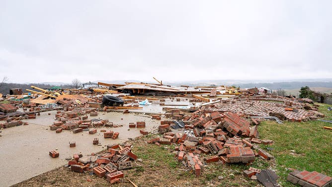
UNION CENTER, WISCONSIN – APRIL 15: Debris is scattered across the yard where a home once stood after a tornado on Tuesday near Raese Road on April 15, 2026 in Union Center, Wisconsin.
((Photo by Kayla Wolf/Getty Images))

Devastating flooding swamps waterfront homes along the Cheboygan River in northern Michigan.
( )
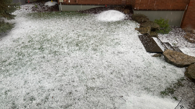
Ping pong ball-sized hail blasts Middleton, Wisconsin, Tuesday.
(Jaxon Brow via Storyful)

Hail pelts cars in Marion, Indiana.
(Wilhelm Mann via Storyful)
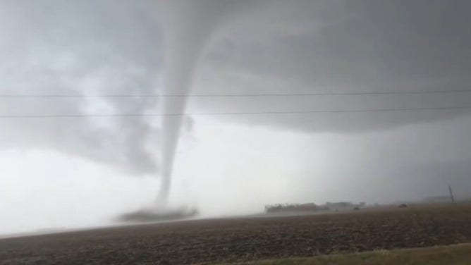
Exclusive FOX Weather Storm Tracker Corey Gerken captured footage of a tornado near Amboy, Minnesota Monday afternoon.
(Exclusive FOX Weather Storm Tracker Corey Gerken)

Golf ball-sized hail falls across Faribault, Minnesota Monday.
(@PETeacher2021 via Storyful)
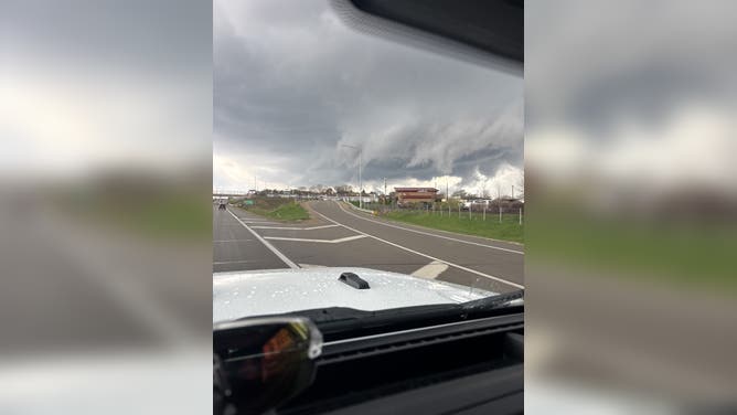
Storms loom over Madison, Wisconsin, Tuesday.
(Robert Reyes)

Severe weather leaves trees down in Colgate, Wisconsin.
(Aleksis)
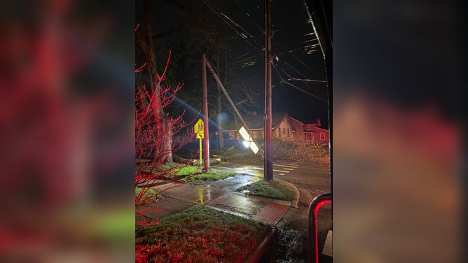
Severe weather snapped trees and power poles in Ann Arbor, Michigan Tuesday.
(The City Of Ann Arbor – Government/Facebook)
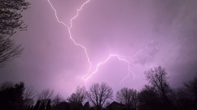
Lightning flashes over Davis, Illinois Tuesday.
(Cari)
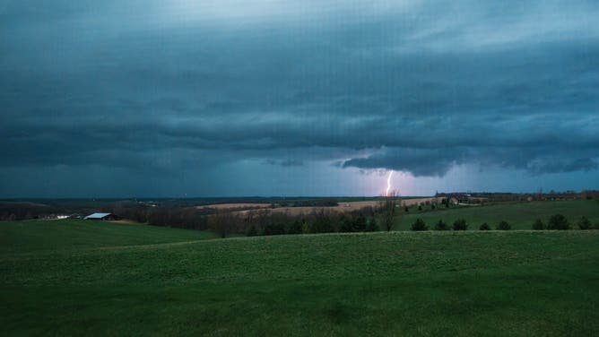
A bolt of lightning strikes the horizon over a rural landscape in Monroe, Wisconsin, on April 14, 2026.
(Ross Harried/NurPhoto)
Much of the Central U.S. has been hammered by rounds of severe weather earlier this week, including destructive flooding in Wisconsin, Texas, and Kansas, alongside several damaging tornadoes across the Midwest.
‘TORNADO ON THE GROUND’: FOX WEATHER STORM TRACKING TEAM INTERCEPTS TORNADO IN IOWA
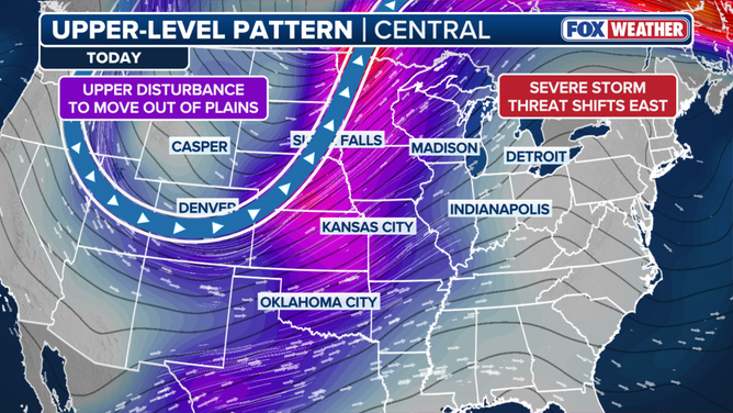
Friday severe weather setup.
(FOX Weather / FOX Weather)
A dip in the jet stream — which acts as an atmospheric conveyor belt for storms — is ushering in an area of low pressure out of the Northwest that will ignite into severe thunderstorms beginning Friday afternoon. These storms will fire up over the middle of the country along the boundary between dry air in the west and moist air from the Gulf that’s heating up the eastern U.S.
NOAA’S Storm Prediction Center (SPC) has issued a Level 3 out of 5 risk of severe thunderstorms across a 700-mile corridor just north of Oklahoma City, through Kansas City, Missouri and into La Crosse, Wisconsin. The Chicago metro area is also within this threat for the most intense storms.
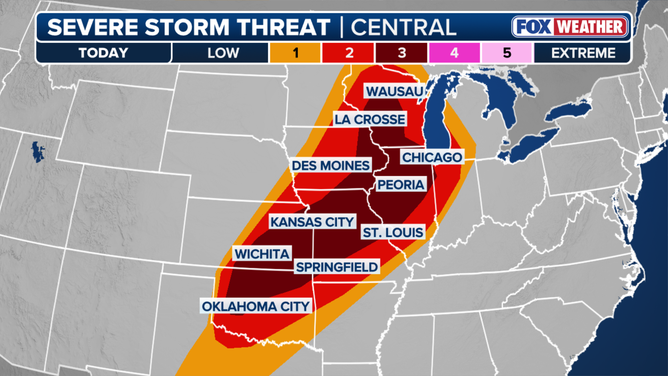
Friday severe weather threat.
(FOX Weather / FOX Weather)
Supercell thunderstorms capable of producing strong (EF-3) tornadoes could form beginning in the early afternoon across parts of Wisconsin, Minnesota, and northeast Iowa.
Supercells are also possible from Kansas City into northern Oklahoma through the daytime hours.
IMMINENT THREAT: RISING WATER LEVELS COULD CAUSE COLLAPSE OF CHEBOYGAN DAM IN MICHIGAN
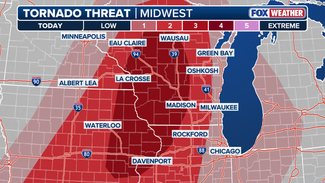
Friday tornado threat.
(FOX Weather / FOX Weather)
These storms could also generate “monster” hail — hailstones greater than 3 inches in diameter.
A broader Level 2 threat stretches from Wichita Falls, Texas through northern Wisconsin and northwestern Indiana. This includes Oklahoma City, St. Louis and Milwaukee.
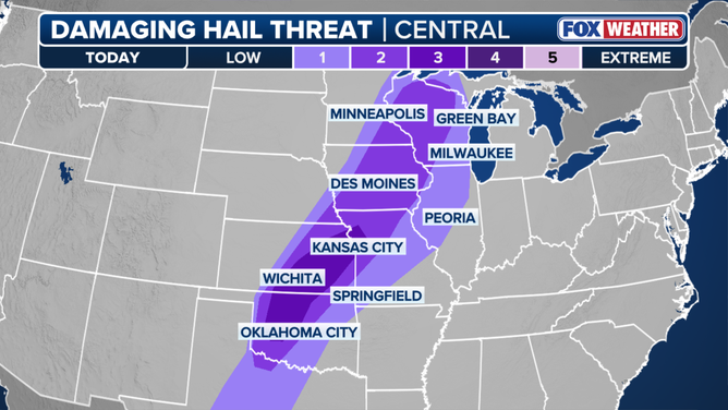
Friday hail threat.
(FOX Weather / FOX Weather)
By the evening and into the overnight hours, damaging wind gusts of 75 mph or greater will become the main hazard across the Plains and Midwest, as the storms may evolve into more of a squall line as they near the Mississippi River.
According to the SPC, northern Missouri, the eastern edge of Iowa and central and northern Illinois, including Peoria and Springfield, are within the bull’s-eye of the damaging wind threat.
PHOTOS: FIREFIGHTERS RUSH TO RESCUE 3 FROM WISCONSIN HOME AMID RISING FLOODWATERS
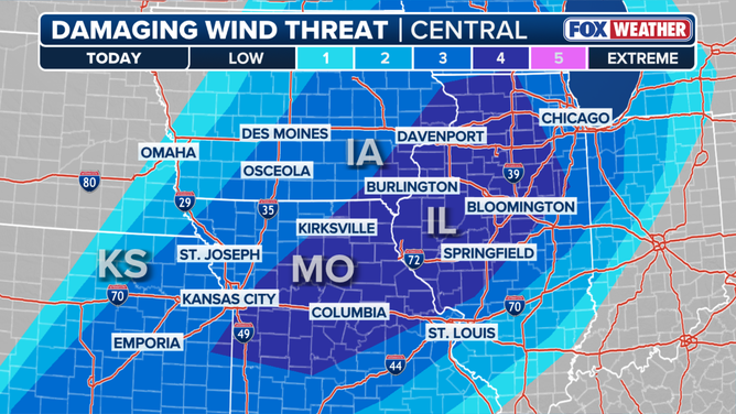
Friday wind threat.
(FOX Weather / FOX Weather)
Through Saturday, the entire system will shift east into the Ohio Valley and Great Lakes regions.
With the associated cold front pushing east, it will likely organize into a line of storms primarily producing damaging winds.
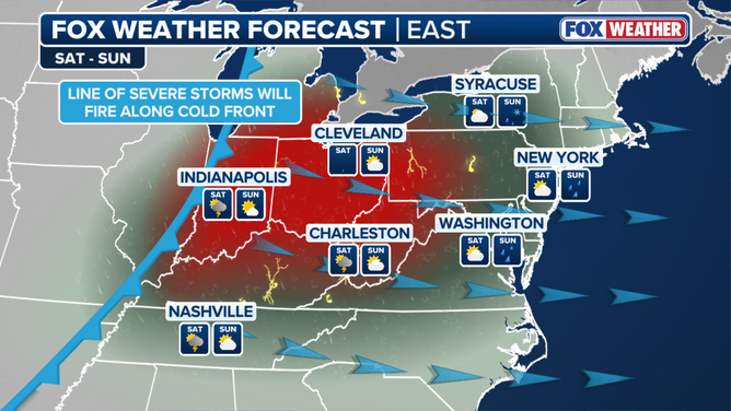
(FOX Weather / FOX Weather)
A Level 2 risk covers eastern Ohio and western Pennsylvania, including Columbus, Cleveland, and Pittsburgh, before storms begin to weaken as they approach the East Coast late Saturday night.
A broader Level 1 threat covers the rest of Ohio, as well as northern Kentucky, much of West Virginia and western New York.
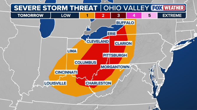
Saturday severe weather forecast.
(FOX Weather / FOX Weather)
These storms will help cool off the eastern U.S. which has experienced a record-breaking heat wave this week, dropping temperatures back into the 50s.
Stay tuned to FOX Weather as we continue to track the development of these storms and provide the latest information to stay safe this week.