Newsletter Subscribe
Enter your email address below and subscribe to our newsletter
Enter your email address below and subscribe to our newsletter


After a warm front brings a windy, sunny Tuesday to Indiana, some scattered showers and storms are possible by nightfall.
INDIANAPOLIS — Our pleasant week of spring weather gets interrupted tonight with some showers and storms across Indiana. Most of the rain will fall tonight while it’s dark. The vast majority of the daylight hours this week will remain dry.
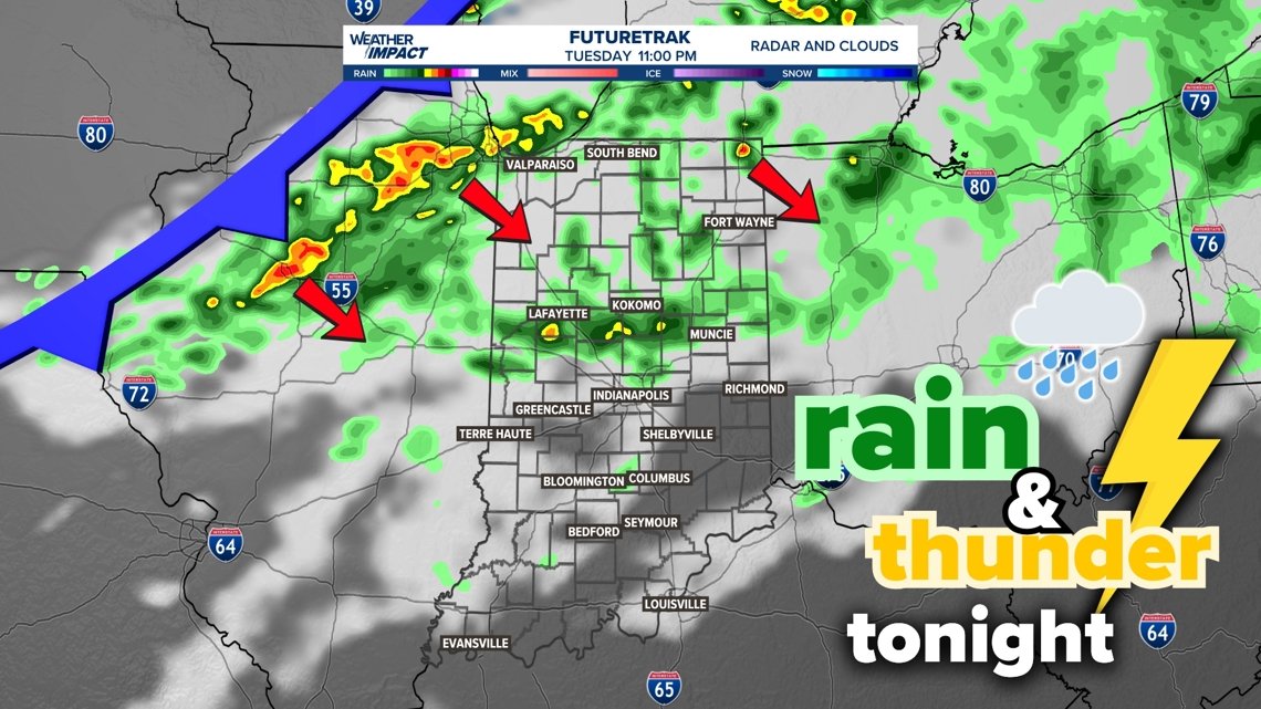
Most of our rain and rumbles arrive in Indiana after 6 p.m., with more rain near Indianapolis specifically after 9 p.m.
Tap HERE to track the approaching rain with our interactive radar.
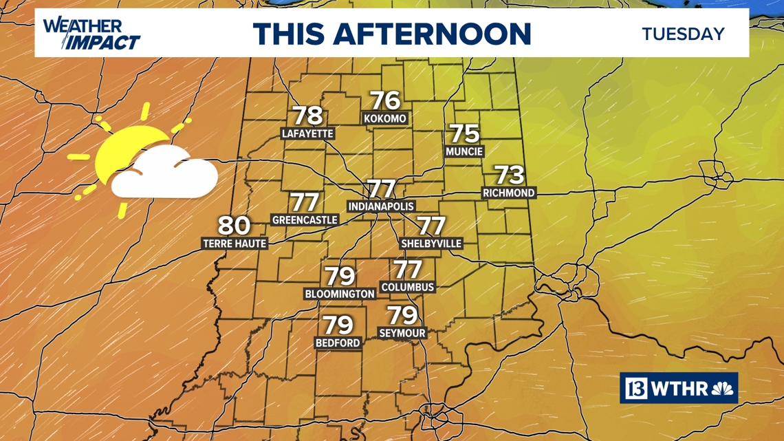
A warm front today will kick up southwesterly wind gusts up to 30-35 mph. This wind should help boost temperatures well into the upper 70s to near 80 degrees. Today will be the warmest day of the week.
Some of the wind may also kick up loose top soil across Illinois and Indiana. Illinois specifically has blowing dust advisories. Don’t be surprised if you see some dust in the air later this afternoon and evening.
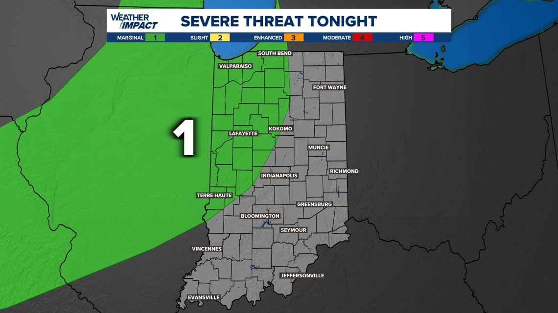
Then, a cold front arrives tonight with some rain and rumbles. Severe threats are very low.
The farther north and west you live, the earlier the rain will arrive. The farther east and south you live, the longer you will wait for rain. Scattered showers and thunder will gradually spread south and east through the late evening and overnight hours.
When will the rain most likely fall (May 12-13):
Let’s start with the arrival of rain. By the evening, showers and weak storms are likely in northwestern Indiana. They will start making a run toward the Indianapolis area near and after sunset.
Showers and rumbles will slowly push south and east.
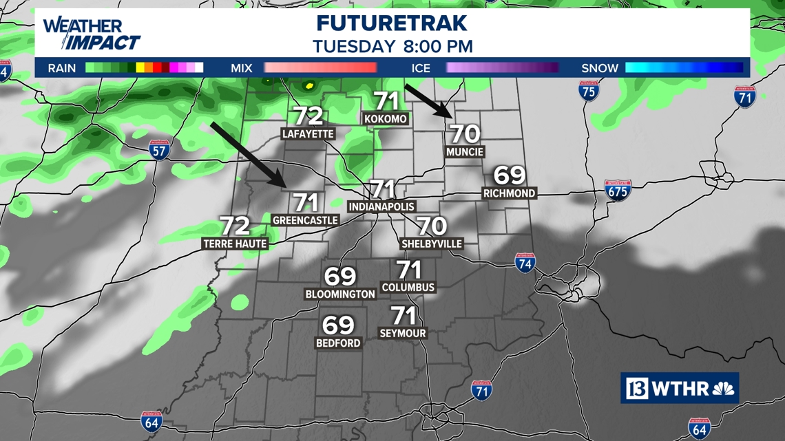
Scattered showers and a few storms are possible. These storms should trend on the weaker side. A rogue severe thunderstorm warning with wind threats is possible, but most Hoosiers can just expect some rain and rumbles.
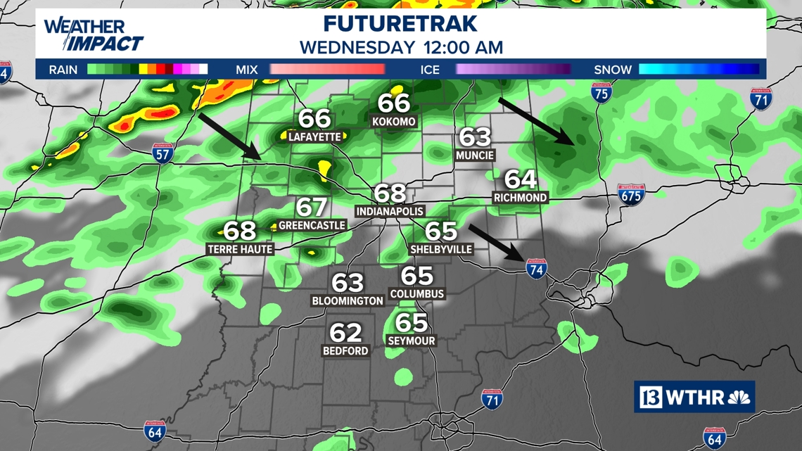
Rain should exit central Indiana around 5-7 a.m. Then, expect some clearing skies with more sun later in the day. There may still be some wet spots as you head out the door, but expect conditions to dry out quickly.
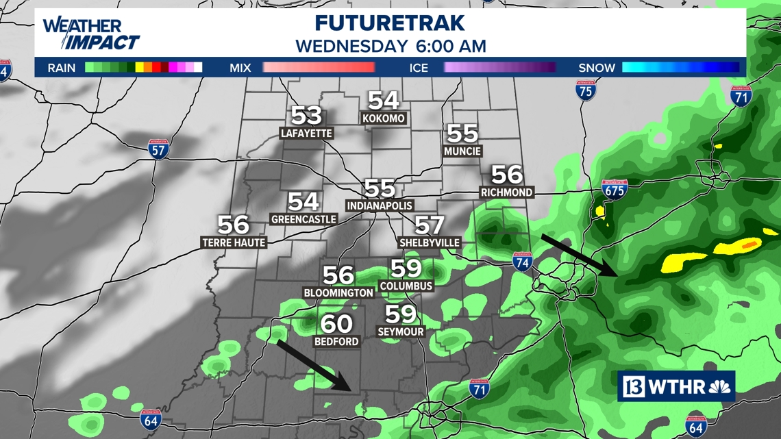
Only a trace to a quarter inch of rain is generally expected tonight. A few locations north of I-70 may see a little more.
The chance for severe weather is really low. A couple severe storms are possible, primarily bringing a wind risk. Most Hoosiers will not get severe weather.
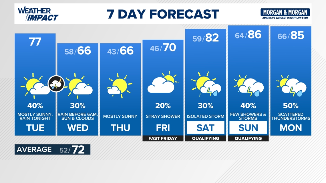
Enjoy mainly quiet weather the rest of the week. Highs will be capped in the 60s, thanks to cooler air from the front tonight. We should rebound to 80s this weekend with scattered rain and storms.