
Newsletter Subscribe
Enter your email address below and subscribe to our newsletter
Enter your email address below and subscribe to our newsletter


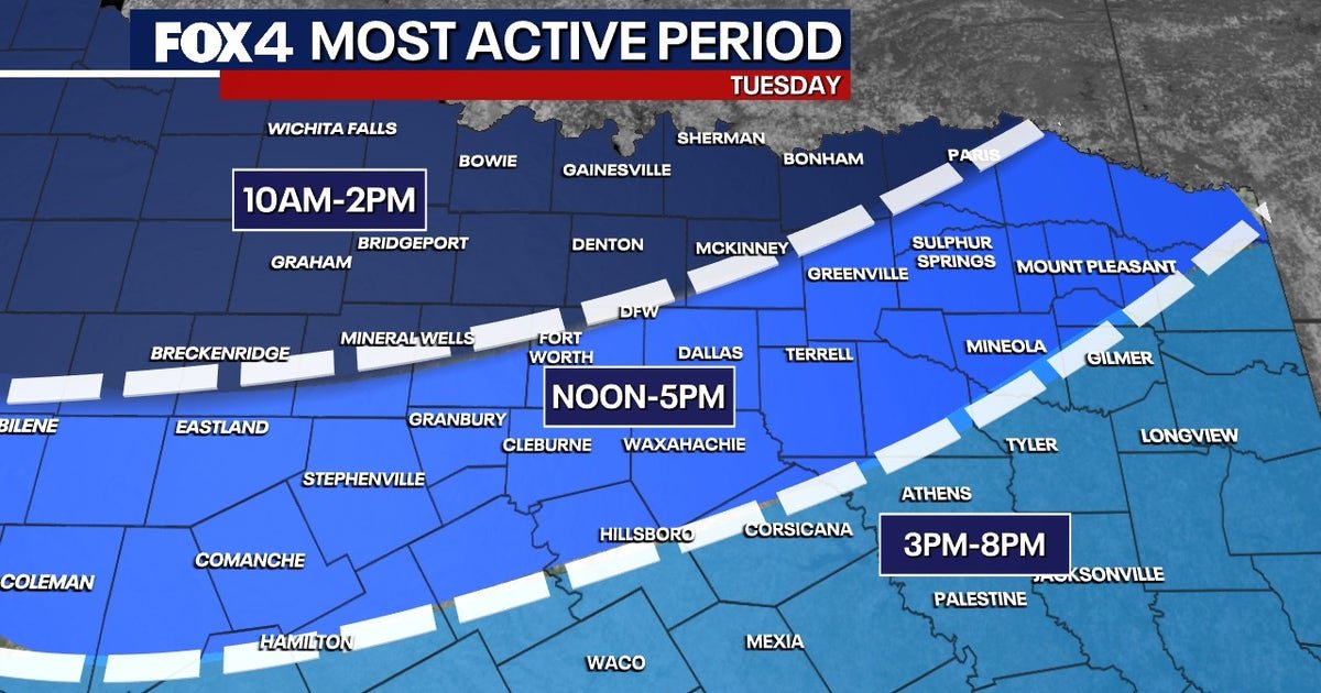
DALLAS – An unsettled weather pattern is bringing severe weather threats back to North Texas this week. Residents should remain weather-aware throughout Tuesday as severe potential sweeps the area.
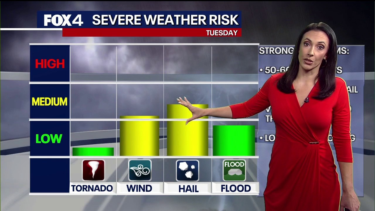
A cold front is pushing a line of showers and thunderstorms into North Texas. These storms bring threats of damaging winds and large hail, with the greatest hail threat southwest of the DFW Metroplex.
Plan for outdoor activities to be interrupted and stay indoors if severe weather hits your area.
The best rain chances will occur Tuesday. The front will stall to our south, while additional disturbances move overhead through the rest of the week.
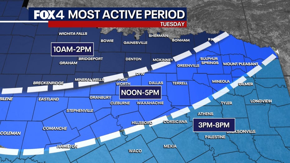
Thunderstorms and locally heavy rain will spread throughout North Texas on Tuesday.
Not everyone will experience severe weather, but residents should pay close attention to severe warning systems during these hours.


Scattered showers and storms remain possible each day, bringing a threat of heavy rain. The active weather pattern will continue into the weekend, with threats of isolated flooding on Wednesday and throughout the weekend.
All of North Texas is expected to receive at least 1 inch of rain Wednesday through Friday, with rain chances ranging from 60% to 90%. The greatest rain threat for DFW is between noon and 6 p.m. Thursday.
The Source: Information in this article comes from the National Weather Service and the FOX 4 Weather Team.