
Newsletter Subscribe
Enter your email address below and subscribe to our newsletter
Enter your email address below and subscribe to our newsletter


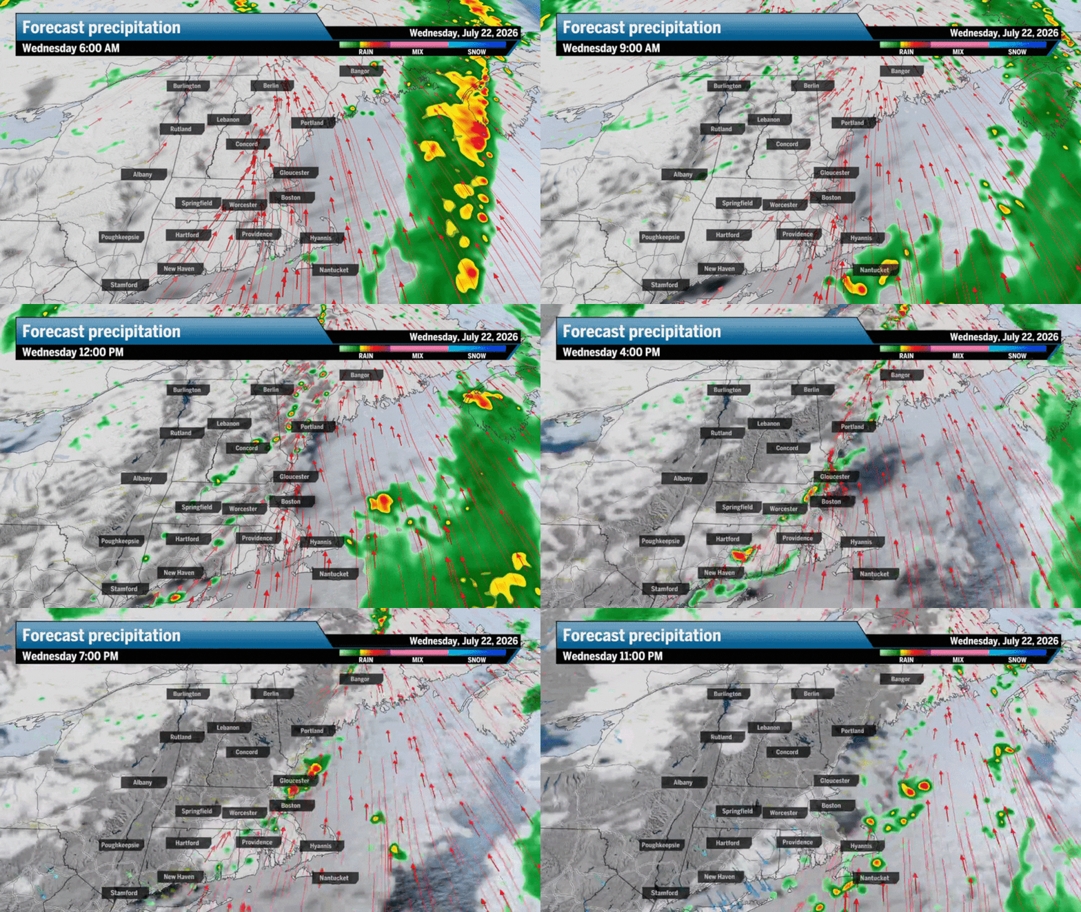
The amount of rain we see will come down to how much heating will push through the clouds before the front arrives.
The passing front will also pull in dry air with it. Wednesday will start outmuggy like Tuesday, with dew points into the upper 60s and low 70s, but as the afternoon progresses, the dry air will drop dew points back into the comfortable 50s and low humidity. Boston, however, won’t really feel the humidity fall until most of us call it a night.

Highs on Wednesday will likely climb to the low and mid-80s across most of Southern New England and most of the region up north. The southerly wind will stay pretty persistent throughout Wednesday, shifting to the southwest during the afternoon.
This should hold the sea breeze back a bit, but the immediate coast will still likely only reach the upper 70s.

Naturally, with a passing summertime cold front, the lighter, moist air will squeeze ahead and the dense, dry air from the front will clash a bit and develop breezy conditions during the afternoon. Some gusts will range from 20 to mph, especially across Boston, the North Shore, and south through the Cape and Islands.

A quick look ahead shows cooler air and dry weather moving into New England for the end of the work week and the weekend. This will be marginally cooler air, but we can expect highs across Boston and most of New England to settle in the 70s for both Saturday and Sunday.


Greater Boston: Mostly cloudy and muggy with scattered showers and thunderstorms, mostly in the afternoon. A bit breezy, highs to the upper 70s along the coast, to the mid-80s in the city.
Central/Western Mass.: Mostly cloudy with a chance for a spot shower or two. Highs to the upper 70s in the Berkshires, low to mid-80s east. Muggy for most of the day until dry air filters in later in the afternoon.
Southeastern Mass.: Mostly cloudy with a breeze building. Highs to the upper 70s. Spot shower chance in the morning and returning in the afternoon.
Cape Cod and the Islands: Spotty showers in the morning under mostly cloudy skies. Breezy at times. Shower chances remain during the afternoon and evening.
Rhode Island: Mostly cloudy with a spot shower chance during the late morning and afternoon. Highs to the upper 70s and low 80s.
New Hampshire: Mostly cloudy with scattered morning showers and a thunderstorm. Highs to the upper 70s and low 80s, warmest south.
Vermont/Maine: Mostly cloudy with a spot shower or thunderstorm chance during the day. Muggy start to Vermont, but turning dry. Maine stays muggy the longest. Highs to the upper 70s across Vermont, low 80s in Maine.
Connecticut: Mostly cloudy skies with a spot shower or thunderstorm. Highs to the low and mid-80s. Muggy for much of the day.
Sign up here for our daily Globe Weather Forecast that will arrive straight into your inbox bright and early each weekday morning. For quick weather updates, follow Ken Mahan on Instagram.
Ken Mahan can be reached at ken.mahan@globe.com. Follow him on Instagram @kenmahantheweatherman.
Source link
More: The Global Track