Newsletter Subscribe
Enter your email address below and subscribe to our newsletter
Enter your email address below and subscribe to our newsletter



TOPEKA, Kan. (WIBW) – Storms are expected to develop this afternoon and move east across the area through this evening. The main threats are large hail and damaging winds, with a couple of tornadoes also possible. Storms could start as early as 2–4 PM in north-central Kansas, with the severe threat ending near I-35 around 10 PM. We should get a break tomorrow with sunshine and lighter winds, but storm chances return this weekend, especially Sunday, though details are still uncertain.
Keys To The Forecast:
First Alert Forecast:
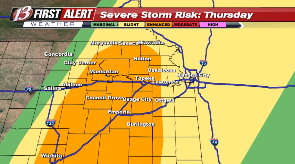
A small disturbance in the upper atmosphere is moving off the mountains toward the Central Plains this afternoon, pushing a dryline and cold front into the area. Newer forecast model guidance brings these features in faster, with the surface trough expected to run roughly from near Washington, KS to Salina by about 3 PM. This quicker timing pulls very dry air into north-central Kansas, leading to very high grassland fire danger this afternoon. With the front moving faster, the most likely area for storms also shifts a bit farther east, closer to that surface trough. As the atmosphere destabilizes this afternoon, helped by a weakening of the “cap,” and some clearing of low clouds, thunderstorms may develop as early as 2–4 PM. If storms form, the setup supports initial supercells, with strong instability and enough wind shear. Early storms could split, and the main threats would be very large hail (up to around 2.5″), damaging wind gusts (60–70 mph), and a tornado or two, although tornado potential may be limited at first due to less favorable low-level winds. As storms merge into a line later in the afternoon and evening, damaging winds become the primary hazard. Tornado potential may increase later as the low-level jet stream strengthens, especially in any north–south positioned segments of the line that can better interact with the wind shear. Confidence is lower on how well the line holds together as it moves east, since lingering clouds in far eastern Kansas could weaken storms, while more widespread clearing would support a stronger, longer-lived line. Flooding risk looks low because storms should move quickly. Severe weather should be done by about 10–11 PM as storms exit.
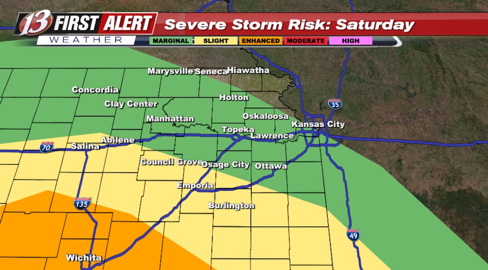
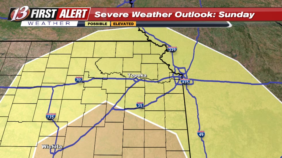
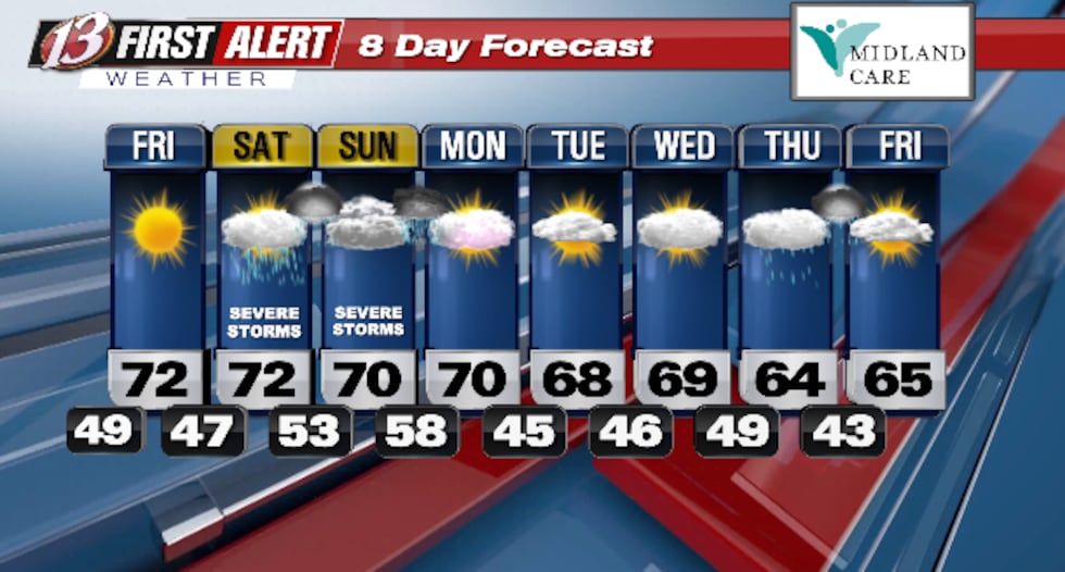
Looking ahead, a more west-to-east pattern sets up Friday into early next week with occasional weather disturbances. Friday should be dry behind today’s system, but storm chances return Saturday, with at least some potential for strong to severe storms. The better severe threat window currently appears Sunday into early Monday with a stronger disturbance, but there’s still plenty of uncertainty in timing, where the warm air sets up, and whether earlier-day rain and storms affect instability. Storm chances fade Monday, with a drier stretch into Tuesday before rain and storm chances increase again Wednesday.
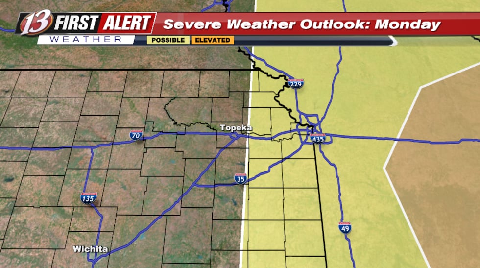
Looking Ahead:
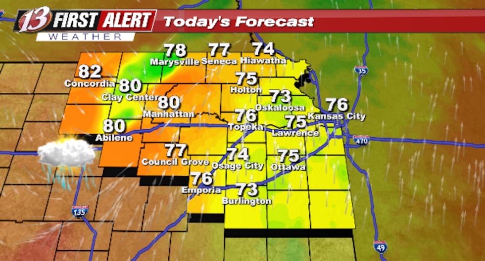
Today: Strong Storms Late. A period of strong thunderstorms during the afternoon hours. Damaging winds and large hail with some storms. High 76F. Winds S at 15 to 25 mph. Chance of rain 70%.
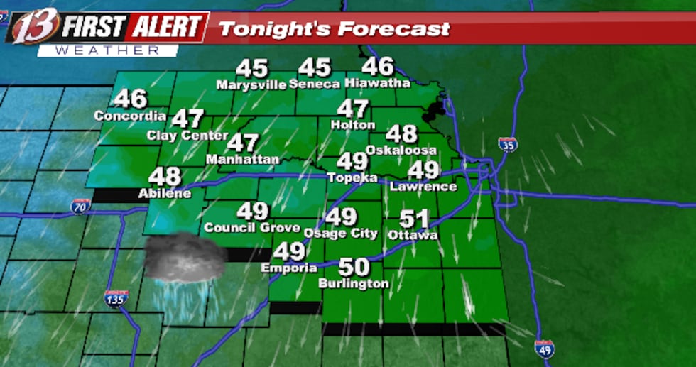
Tonight: Thunderstorms Early. Thunderstorms, some locally heavy early, then partly cloudy after midnight. Severe thunderstorms expected. Low 49F. SW winds shifting to N at 10 to 20 mph. Chance of rain 90%.
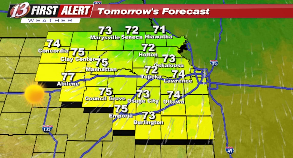
Tomorrow: Sunny. Mainly sunny. High 72F. Winds NNE at 5 to 15 mph.
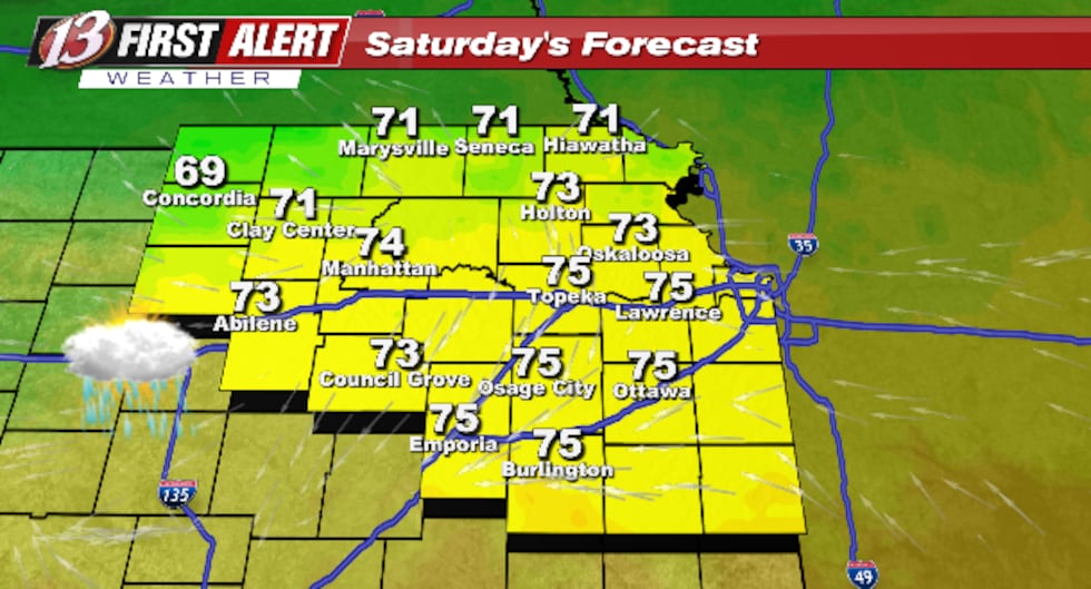
Saturday: PM Thunderstorms. Partial cloudiness early, with scattered showers and thunderstorms in the afternoon. Potential for severe thunderstorms. High 72F. Winds ESE at 10 to 15 mph. Chance of rain 30%.
As always, be sure to check in daily for updates, and when storms are in the area, utilize the WIBW Weather App
Copyright 2026 WIBW. All rights reserved.