Newsletter Subscribe
Enter your email address below and subscribe to our newsletter
Enter your email address below and subscribe to our newsletter


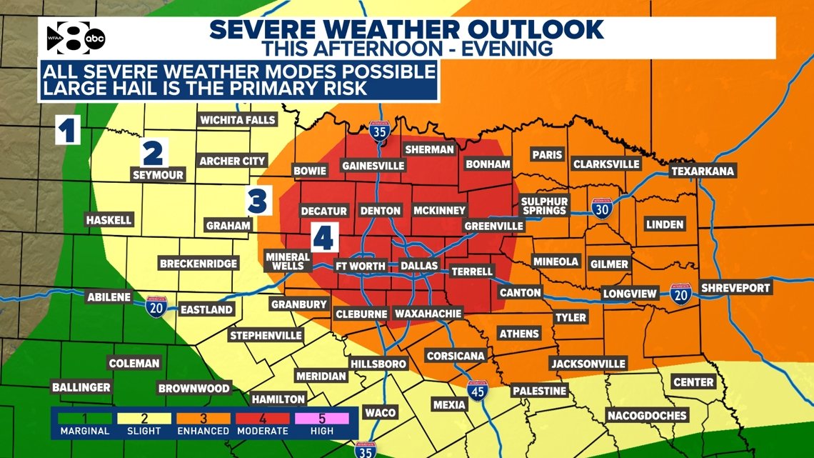
Strong to severe storms could develop this afternoon.
DALLAS — Stay informed by watching regular forecast updates and live radar from across the region on our smart TV streaming app, WFAA+. You can also download the WFAA mobile app for up-to-the-minute alerts from our weather team as they come.
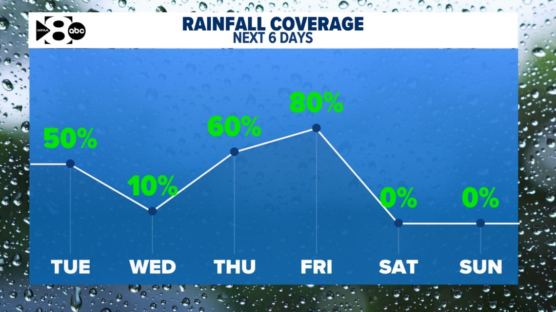
Another wave of rain and storms will be possible on Tuesday. As of today, the coverage looks at about 70%. Not everyone will see storms.
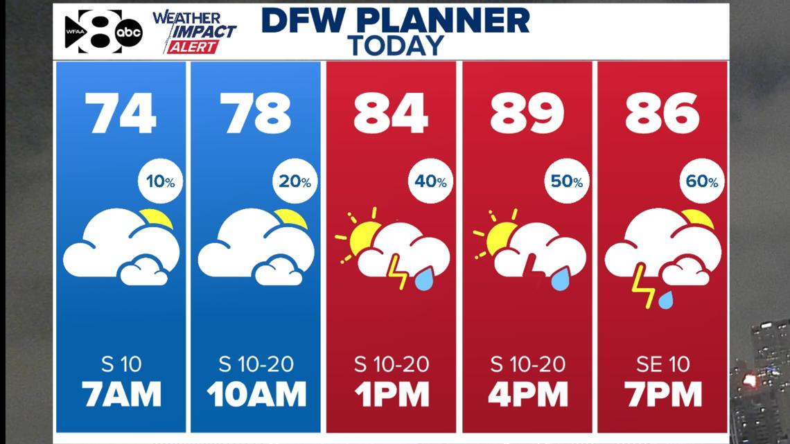
The timing looks to be late afternoon and into the evening with severe weather possible, including quarter to golf ball to baseball size hail and wind gusts of at least 60 mph. These storms will also pose a low tornado threat. The highest storm coverage will be in eastern North Texas late afternoon. Large hail and strong winds will be the main concern.
A few storms are possible this morning over the far northwest portion of North Texas. These storm will pose mainly a hail threat through around Midday. Storms are expected over the rest of of the area this afternoon and evening. Large to very large hail, damaging winds and a low tornado threat are the concerns.


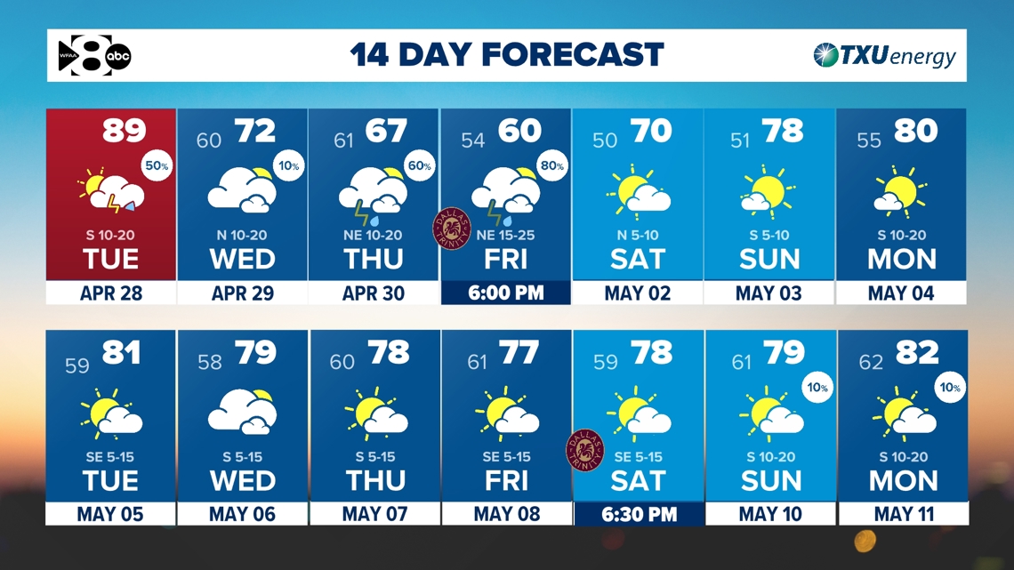
A few severe storms are possible Tuesday. The chance for rain on Wednesday looks pretty low for any one location. Widespread rain with no severe risk is possible by Thursday and Friday. That comes with much cooler temperatures, too.
We have one more day with unseasonably warm temperatures expected. A strong cold front arrives late Tuesday night bringing temperatures down several degrees below normal on Wednesday. Incoming rain chance and a breezy north wind will send temperatures into the 60’s for a few days by the end of the week!
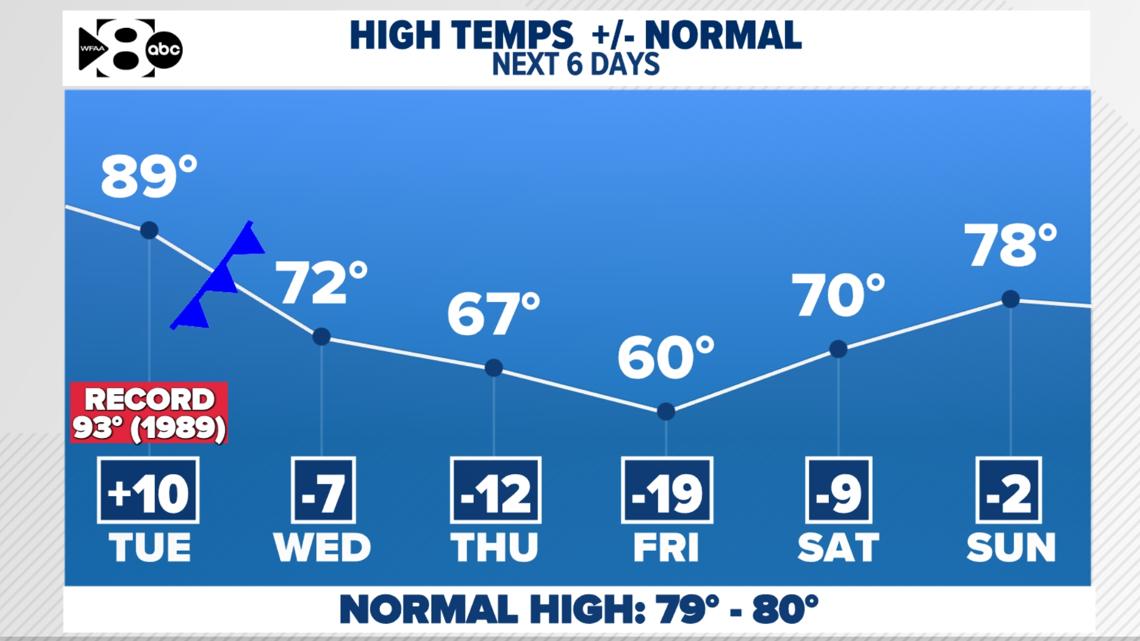
The pattern still looks fairly unstable in the week ahead with several chances of rain and storms. Severe storms are possible as early as today through this evening. Widespread rain is possible Thursday and Friday, but severe weather is extremely unlikely with how cool it will be!